You're about to create your best presentation ever

Geography Presentation Template

Create your presentation by reusing one of our great community templates.

Human Geography Template

Transcript: Human Geography Presentation Introduction Introduction Sustainability at UF has been an ongoing goal since 2001 when the University adopted the US Green Building Council codes. In 2009 they made a detailed plan that set goals that would be implemented and assessed through an annual report every three years. While ambitious goals are important accountability through independent evaluation is essential to successful implementation and review. Hypothesis Sustainability implementation on the University of Florida campus has had varied success and mixed overall knowledge across the campus. Flesh out methods Focus on fleshing out background by avoiding temporal gap by keeping narrative talk about why the indicators were chosen Methods Consulting archival documents and quantitative data in archival documents from the University of Florida Survey a population of various students to assess their perception of sustainability on the campus Assess with the following criteria in mind: land cover, trash can and recycling centers, water fountain distribution, and sustainable building practices Background In 2009 the University of Florida adopted the LEED building standards and required through three iterations to build all new buildings to LEED-Gold Certifications. In 2006 the University of Florida began implementing the Recylcing program through the office of sustainability at football home games with the intent to spread the program to regular activity on campus. In 2017 the Campus Master Plan was updated with amendments and future building sites. Land Cover Land Cover 77 of the listed projects are additions Of the current projects 11 being worked only two of them are demolition and construction programs, six of them involve upgrading or renovation to make space more efficient, and three are cosmetic or office moving. There are 11 projects in the design phase and 8 in planning phase. These projects are all in accordance with the Master plan and LEED building standards. Current Projects and Further Elaboration Construction and renovations allow for preservation of historic spaces to be updated. It sounds counter intuitive, but as technology has improved and emissions from waste can be reduced upgrading technology allows for reduced emissions. Although beyond the scope of this study there are areas of preservation and building available at this link. Pros and Cons of Construction Surveyed Perception Recycling Trash Can and Recycling Centers With current initiatives, UF achieves a waste recycling rate of nearly 40%, or over 6,000 tons of material annually. "I like to think we have things pretty well controlled and inventoried, as far as where the thousands of recycling bins and recycle stations are located – both inside and outside. That is, until the Big Belly invasion. The addition of those 70+ stations resulted in the fast & furious removal and relocation of probably 120 or more previous stations. I have made many corrections to my lists, but I’m not comfortable with the accuracy any more." Current knowledge of Recycling and Waste Management The amount of water fountains is unknown, however with the data provided by surveyors approximations can be made. There are at least 100 water bottle refill stations and the minimum of those survived is over 30,000 water bottles saved during the duration of the refill time. 11 people daily use of refill stations as daily use surveyed Less than 17 oz: 85 oz Around 34 oz: 340 oz Between 34oz and 17oz: 272-136 oz With those estimates applied to the University population there can be a maximum number of 184,512 gallons and minimum of 148,510 gallons used refilling water bottles a day from refill stations. Water Fountain Distribution Water Fountains All of the 17 people we surveyed were content with their access to water refill stations yet if they ran into a problem with them only 1 person knew who to contact. Net zero emissions were stated as a goal by 2015, yet on the sustainability timeline there is not mention or report updating the progression of this goal. There was supposed to be an annual report every three years since the 2009 CAP was implemented yet the three expected follow-ups have not been provided. Access to Information Access to Information There have been drastic improvements, however there is still a requirement for interested parties to contact an email address. They may not always provide the answer that you would like to hear or have information to sufficiently answer your question. However, there is credit to be given to the allocation of staff to answer concerned parties' questions. "UF will track and publicly report annual boundary-scale upgrades with goal of increasing spatial and temporal resolution over time." The last report with accordance to this policy is from 2009 and you need to go through multiple pages to accumulate statistics on multiple topics. Infrastructure and Funding There is enforcement and implementation from the University of Florida Campus

Geography Presentation Template

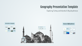
Transcript: Geography Presentation Template Exploring Turkey and Istanbul’s Büyükçekmece Introduction to Geography Focus on Büyükçekmece Turkey - A Geographic Overview Importance of Geography Physical vs. Human Geography Key Attractions Geography helps us comprehend spatial relationships and the impact of location on cultural, economic, and political dynamics. It's essential for urban planning, environmental conservation, and global awareness. Physical geography focuses on natural features and processes, such as landforms and climate, while human geography examines societal dynamics, urban development, and cultural landscapes. Location within Istanbul Major Regions of Turkey Climate and Environment Location and Borders Cultural Geography Turkey features a varied climate, ranging from Mediterranean along the coast to continental in the interior. Its rich natural resources and biodiversity, including mountainous terrains and fertile plains, support agriculture and wildlife, making Turkey ecologically significant. Turkey is divided into seven diverse geographical regions: Marmara, Aegean, Mediterranean, Central Anatolia, Eastern Anatolia, Southeastern Anatolia, and Black Sea. Each region boasts unique climatic conditions, cultures, and historical sites, reflecting the country’s rich tapestry of diversity. Nestled at the crossroads of Europe and Asia, Turkey is bordered by eight countries, including Greece and Armenia, with coastlines along the Aegean, Mediterranean, and Black Seas. This strategic location has historically made Turkey an important hub for trade and cultural exchange. The cultural geography of Turkey is characterized by a blend of traditions influenced by various civilizations, from Byzantine to Ottoman. This cultural mix is evident in Turkey's architecture, arts, and cuisine, symbolizing the harmonious coexistence of diverse ethnic groups and religions. Büyükçekmece is located on the European side of Istanbul, along the coast of the Sea of Marmara. It serves as a vital transit point connecting the city’s urban life with its natural landscapes. Büyükçekmece is home to several attractions including the Büyükçekmece Beach, known for its recreational activities, and the historic Büyükçekmece Aqueduct, an architectural marvel of the Ottoman period. Geographic Information Systems (GIS) Overview of Major Geographic Features Environmental Features GIS technology allows for the visualization and analysis of spatial data. It plays a critical role in various fields, including urban planning, environmental management, and disaster response. Major geographic features include mountains, rivers, deserts, and plains. Understanding these features is vital for grasping climate patterns, biodiversity, and human settlement adaptability. Cultural Significance and Development The district boasts scenic beaches along the coast and expansive parks, contributing to its biodiversity. Its proximity to the Sea of Marmara offers unique coastal ecosystems, making it a favorable spot for both locals and tourists. Büyükçekmece has evolved into a vibrant cultural hub, showcasing various festivals and events that highlight its heritage. The district reflects a blend of modern developments and traditional lifestyles, making it a unique part of Istanbul. Istanbul - The City of Many Layers Historical Significance Istanbul, formerly known as Byzantium and Constantinople, is steeped in over 2,500 years of history. It has served as the capital of three empires: Roman, Byzantine, and Ottoman, making it a focal point for cultural and political transformations in the region. Geographic Features Economic Importance Istanbul is Turkey's economic powerhouse, contributing significantly to the nation's GDP. It hosts major industries such as trade, manufacturing, tourism, and finance, making it a critical hub for commerce. Istanbul spans two continents, Europe and Asia, divided by the Bosporus Strait. Its unique topography includes the Golden Horn, a natural harbor, and hills that provide stunning views of the city’s skyline and waterways. Demographics and Population Distribution Istanbul is home to over 15 million residents, making it one of the largest cities in the world. Its population is diverse, with various ethnic backgrounds and cultures, contributing to its vibrant social fabric.

Template Presentation

Transcript: Assessing the Maritime Students’ Perceptions and Preparedness of Coastal Resilience: A Descriptive Correlational Study BSMT SII-BRAVO (GROUP1) OBJECTIVES: The sole purpose of the descriptive correlational study is to investigate fundamental research inquiries through a comprehensive assessment of the level of awareness, perception, and readiness among maritime students about coastal resilience. The chapter presents the findings from the data gathered. The chapter is organized into themes that go along with the sub-themes obtained through thematic analysis which is also derived from the research questions. The result is hereby integrated with the information gathered from the interviews. To examine the extent of maritime students' awareness of coastal resilience and its importance. To investigate the opinions of maritime students regarding coastal hazards and theirpossible impact on many elements of maritime activity. To evaluate the preparedness of maritime students in implementing coastal resiliencemethods within their field focuses on assessing their readiness. To recommend practical suggestions for enhancing the education and training ofmaritime students within the framework of coastal resilience and monitoring systems. CONCLUSION: 1. The extent of maritime students' awareness of coastal resilience and its importance is very pivotal in achieving success. 2. The opinions of maritime students regarding coastal hazards and their possible impact on many elements of maritime activity differs from their educational backgrounds, views, opinions, and perspectives that can be seen from positive and negative statements. 3. The preparedness of maritime students in implementing coastal resilience methods within their field focuses on assessing their readiness. 4. The recommended practical suggestions for enhancing the education and training of maritime students within the framework of coastal resilience and monitoring systems will be a great leap towards total quality achievement. RECOMMENDATIONS: 1. School administrators may support the development of practical suggestions for enhancing the education and training of maritime students within the framework of coastal resilience and monitoring systems. 2. Strengthen or maintain development programs for maritime students that nurture the development of their personal life and professional role. 3. The education and training of maritime students within the framework of coastal resilience and monitoring systems may be reviewed, refined, and later used to guide researchers. 4. Future researchers may use this study as a reference for further study on variables that were not explored in this study. This descriptive correlational study evaluated maritime students' views of and readiness for coastal resilience in order to prevent problems in the near future. The purpose of this study was to determine how good the maritime students were in understanding the ideas of coastal resilience and how equipped they were to handle issues that may arise along the coast. The findings showed that most of the participants had awareness and comprehension about the topic. While most of them also agreed that it is still dangerous for reducing the effects of climate change and natural disasters. Findings also revealed that there were differences in their level of practical readiness to deal with these problems since they differ from aspects as observed in their demographic profiles. This study which is a qualitative research provided themes and subthemes, through thematic analysis of the concept the focuses on the information and solicited opinions of the female participants. Findings from the data analysis have been organized by themes, with each theme referencing several sub themes and codes from the analysis

Now you can make any subject more engaging and memorable